
The Best Photography Apps 2026: Essential Tools Beyond the Camera
Discover the best peripheral photography apps for 2026, from PhotoPills and weather forecasting to location scouting, tides, astronomy, wildlife identification and professional planning tools. These are the apps that help photographers before the shutter is ever pressed.
There was a time when preparing to make a photograph meant packing a camera, checking that there was film in the bag and perhaps glancing at the weather forecast before leaving home. Photography in 2026 can look rather different.
Long before I press the shutter, my smartphone can tell me precisely where the sun will rise, when the light will strike a particular building, whether cloud is likely to obscure it, what time the tide will turn, where the Moon will appear, whether fog might form overnight and even where the Milky Way will sit above a landscape I haven’t yet visited.
It can identify the mountain in front of me, the bird I can hear but cannot see, an aircraft crossing the sky or a ship approaching the coast. It can give me an Ordnance Survey map, find a footpath, record an exact location, provide an emergency position and allow me to obtain a signed model release without a sheet of paper changing hands. None of these applications necessarily takes a photograph. That is precisely why I find them so interesting.
We spend an enormous amount of time talking about camera apps and editing apps, but considerably less discussing the expanding ecosystem of applications that surrounds contemporary photographic practice.
I think of these as peripheral photography apps: applications that help us research, anticipate, navigate, understand and respond to the world before — and sometimes after — the photograph is made.
Some have become indispensable to me. Others solve very particular photographic problems. A few are applications that photographers may never have considered using photographically at all.
This is my guide to the ones I think are genuinely worth knowing about in 2026.
1. PhotoPills
Best overall photography planning app

If I could install only one specialist planning application on a photographer’s phone, PhotoPills would be extremely difficult to beat.
Calling it a Sun and Moon app considerably understates what it has become.
PhotoPills allows photographers to plan the position of the Sun, Moon, and Milky Way for a particular location and date, visualise alignments using augmented reality, investigate meteor showers and eclipses, and calculate everything from depth of field and hyperfocal distance to long exposures, field of view, and time-lapse sequences.
What I particularly like is the shift it encourages from finding a photograph to anticipating one. Imagine finding a church, monument, tree or piece of architecture and wondering whether a full Moon could ever rise directly behind it. PhotoPills allows you to move forward through time and investigate when that alignment might occur. The photograph may therefore begin months before the shutter is released. That changes our relationship with photographic time in quite an interesting way.
My recommendation: Essential for landscape, architectural, travel, night and astronomical photographers.
Platforms: iOS and Android.
2. The Photographer’s Ephemeris
Best for serious location and light planning

The Photographer’s Ephemeris — usually known simply as TPE — has been part of photographers’ planning vocabulary for years, and for good reason.
An ephemeris describes the predicted positions of astronomical objects over time, but TPE translates that rather intimidating concept into something visually useful for photographers.
You can investigate where the Sun and Moon will rise and set relative to a particular location, study light direction and plan compositions well before arriving. For architectural and landscape photography, this can be enormously useful.
If I want light to fall along a particular side of a building rather than simply knowing that sunset occurs at 20:14, TPE is helping answer the more important photographic question.
Where will the light actually be?
That distinction runs throughout this guide. Generic information becomes far more valuable when interpreted photographically.
My recommendation: One of the strongest choices for photographers who enjoy meticulous planning.
3. Sun Surveyor
Best visual Sun and Moon planner

Sun Surveyor takes a particularly visual approach to solar and lunar planning.
Its Live Camera View, interactive mapping, 3D compass and ephemeris make it possible to visualise the paths of the Sun and Moon, while also covering golden hour, blue hour, moon phases, Milky Way positioning and star trails.
I particularly like augmented-reality tools for this kind of planning because astronomical numbers alone can feel abstract. Hold a phone towards a landscape and suddenly the information becomes spatial.
You can begin asking:
Where will the Sun disappear?
Will the Moon clear that building?
When will this street become illuminated?
That is far more intuitive than studying sunrise and sunset times in isolation.
My recommendation: Particularly good for photographers who think spatially and visually.
WEATHER: STOP ASKING WHETHER IT WILL RAIN
Weather applications become much more interesting when we stop treating them merely as tools for deciding whether to carry an umbrella.
For photographers, weather is part of the image.
Cloud type, cloud height, visibility, humidity, wind direction, mist, atmospheric pressure and precipitation can completely transform the visual character of a location.
And sometimes the supposedly “bad” weather is precisely what we need.
4. Met Office
Best everyday UK weather app

For photographers working in Britain, I think the Met Office app should be on the phone.
Importantly, the application was rebuilt in 2026. The refreshed app launched in January, and the previous legacy application was retired in July.
The new version provides hourly and seven-day forecasts alongside weather warnings and interactive mapping for rain, cloud and temperature. It also includes visibility, humidity, pressure, UV, pollen and air-pollution information, as well as specialist mountain and beach forecasts.
Several of those apparently secondary measurements are extremely useful photographically.
Visibility can matter enormously for landscapes. Humidity may contribute to mist. Wind affects water, foliage, long exposures and drone operations. Cloud determines whether the spectacular sunset you’ve imagined is going to exist at all.
My recommendation: The first weather app I would install for UK photography — but not necessarily the last.
5. Windy
Best for seeing weather systems
Windy is one of those applications that becomes increasingly useful the more you understand what you’re looking at.
Rather than simply giving you a forecast icon, it encourages you to examine weather spatially.
Wind, cloud, precipitation, pressure and other meteorological information can be visualised across maps, making it much easier to understand what is approaching your location.
For landscape photographers in particular, that broader geographical picture can be considerably more valuable than seeing a small rain-cloud icon beside “17:00”.
Weather moves.
Windy helps you see that movement.
My recommendation: Excellent companion to a conventional forecast.
6. Clear Outside
Best for cloud-conscious night photographers

Clear Outside was developed with astronomy in mind, but that makes it particularly useful to astrophotographers.
The important difference is cloud detail.
Someone photographing the night sky doesn’t merely want to know that it will be “partly cloudy”. The amount and height of cloud matter enormously.
Low, medium and high cloud can have very different consequences for the photograph you’re planning.
It is another example of why specialist information frequently beats a general forecast.
My recommendation: Keep it alongside PhotoPills if you regularly photograph stars or the Milky Way.
7. Inverza
The one I’m watching most closely

This is perhaps the most interesting newcomer in this entire guide.
Inverza approaches weather specifically from a landscape photographer’s point of view.
Instead of requiring us to interpret a collection of meteorological variables ourselves, it attempts to predict photographic conditions.
Those can include colourful dawns, afterglow sunsets, dramatic storm clouds, ground fog, cloud inversions, lenticular clouds, fresh snow, soft light, reflecting water, aurora, the Belt of Venus and even Brocken spectres. That is a fascinating conceptual shift. Traditional weather applications tell us what the atmosphere may do.
Inverza attempts to answer:
Is the atmosphere likely to do something worth photographing?
I wouldn’t surrender photographic judgement to an algorithm — unpredictability remains one of photography’s great pleasures — but I find this development genuinely interesting.
It also raises a larger question. As apps become better at predicting photogenic conditions, will photographers increasingly converge on the same places at precisely the same moments?
Technology can increase our opportunities while simultaneously reducing serendipity.
My recommendation: One to explore rather than blindly obey. This is an application I want to watch.
TIDES, WATER AND COASTLINES
A beautiful sunset is not terribly useful if the foreground you intended to photograph is under two metres of seawater.
Coastal photographers should treat tide information with the same seriousness that they treat light.
8. My Tide Times

For coastal work, a straightforward tide application can be invaluable. High and low tide times allow you to determine not only whether a location is accessible, but what the landscape itself may look like.
A beach at high tide and the same beach six hours later can effectively be two different photographic locations.
Rock formations appear. Reflections disappear. Sandbars emerge. Causeways become accessible — or dangerously inaccessible.
My recommendation: If you photograph the coast, install a reliable local tide app and make checking it habitual.
And never allow an application to override local safety warnings or common sense.
FINDING THE PHOTOGRAPH
Location scouting is another area where smartphones have radically changed photographic practice.
We can now scout somewhere without actually being there.
Whether that is entirely a good thing is another interesting question.
9. PhotoHound
Best dedicated photography location finder

PhotoHound is built specifically around photographic locations rather than generic tourism. That distinction matters. A tourist guide may tell you that a waterfall is beautiful.
A photographer wants to know where to stand, when the light works, what access is like and what photographic possibilities actually exist.
PhotoHound provides photography spots and guides and allows photographers to save locations and organise potential trips.
I particularly like the community element because photographic knowledge has always travelled between photographers: locations, viewpoints, access, seasonal conditions and the tiny pieces of information that rarely appear in conventional travel guides.
My recommendation: Particularly useful when travelling somewhere unfamiliar.
10. Google Earth
Best virtual scouting tool

Google Earth isn’t a photography app. That is precisely why it belongs in this article. For virtual scouting, it remains extraordinarily useful.
Satellite imagery and 3D terrain allow us to understand geography before arriving. I can investigate the orientation of a coastline, the relationship between buildings, possible elevated viewpoints and the broader topography surrounding a location.
Combine Google Earth with PhotoPills or TPE, and you have a remarkably sophisticated pre-visualisation system.
This is where peripheral apps become powerful: not individually, but in combination.
Google Earth tells me what the land looks like.
PhotoPills tells me where the Sun might be.
Windy tells me what the atmosphere may be doing.
A tide application tells me where the water will be.
The photograph is gradually constructed from information.
11. Google Maps

It is so ubiquitous that it is easy to overlook Google Maps as a photographic tool. Street View alone makes it enormously useful for scouting urban photography. Before travelling, I can investigate possible viewpoints, roads, parking, public transport and walking routes.
But I would issue one warning. Do not scout the spontaneity out of photography. Knowing exactly what every street looks like before arriving can remove the experience of discovery that makes street and documentary photography so rewarding.
Use maps to get there. Then occasionally put the phone away.
12. OS Maps
My UK landscape choice

For photographers working in the British countryside, Ordnance Survey mapping remains enormously valuable.
Public rights of way, contours and landscape detail provide information that ordinary road mapping simply doesn’t.
It is particularly useful when the interesting viewpoint isn’t beside a road.
For landscape photographers, understanding terrain is part of understanding the photograph.
13. PeakFinder
One of my favourite unexpected photography tools

Point PeakFinder towards a mountain skyline and it can identify the peaks in front of you.
Its database covers more than a million peaks worldwide and, importantly, the panoramic mountain functionality works offline. That last point matters.
Some of the places where PeakFinder becomes most useful are precisely the places where your mobile signal disappears.
For photographers, I see two uses. The obvious one is identifying what we have photographed. The less obvious one is understanding the geography of a landscape while composing it.
Knowing that distant peak has a name changes our relationship with the landscape. It transforms anonymous scenery into place.
My recommendation: Wonderful for landscape and travel photographers.
KNOW EXACTLY WHERE YOU ARE
14. what3words

what3words divides the world into small squares and assigns each one a three-word address. Photographically, it can be useful for recording exact viewpoints, meeting collaborators or communicating a precise location.
It can also be useful in an emergency, although photographers should always follow the location method requested by the relevant emergency service and carry appropriate navigation tools in remote terrain.
For location notes, though, three words are considerably easier to record than a long set of coordinates.
LOOK UP
Some of the most useful photographic applications aren’t aimed primarily at photographers at all.
15. Stellarium
Best for understanding the night sky

Stellarium effectively puts a planetarium in your pocket. For night photographers, it makes the sky understandable rather than simply beautiful.
Stars, planets, constellations and astronomical objects can be identified and explored, helping photographers understand exactly what they are pointing their cameras towards.
Combined with a photographic planner, it becomes particularly powerful.
PhotoPills may help me plan the photograph.
Stellarium helps me understand the sky within it.
16. AuroraWatch UK

For British photographers interested in aurora photography, alerts can mean the difference between being outside with a camera and discovering the following morning that everyone else photographed the sky turning green.
The AuroraWatch UK service at Lancaster University monitors geomagnetic activity relevant to auroral visibility from Britain. The AuroraWatch UK app shown above, developed independently by Progress Concepts, uses data from that service and adds its own mapping, cloud and forecast functionality for photographers and other aurora watchers. The important word is alert. Some photographic conditions are too transient for us to check manually every few hours.
This is where notifications become genuinely useful photographic tools.
IDENTIFY WHAT YOU ARE PHOTOGRAPHING
One of the quieter revolutions in smartphone photography has nothing to do with image quality.
It is our increasing ability to understand the subject in front of the camera.
17. Merlin Bird ID
An extraordinary companion for wildlife photographers

Merlin Bird ID, from the Cornell Lab of Ornithology, can help identify birds by appearance and, remarkably, by sound. For photographers who aren’t specialist ornithologists, this can completely change a walk through woodland. You may hear a bird before you see it. Identification gives you a clue as to what you’re looking for and potentially how it behaves.
More importantly, it encourages photographers to learn about their subjects rather than treating wildlife merely as visual material.
My recommendation: One of the best free additions to a nature photographer’s phone.
18. iNaturalist

iNaturalist extends that idea much further across the natural world. Plants, insects, fungi and animals can all become subjects of identification and observation.
For photographers documenting biodiversity, environmental change or simply exploring unfamiliar environments, this can turn photographs into records as well as images.
There is something particularly appropriate about using a camera not simply to extract an image from nature but to understand what we encountered.
19. Seek by iNaturalist

Seek offers a more immediate identification experience and can be especially enjoyable when exploring.
Point the camera towards living things and attempt to identify them.
For photographers beginning environmental or nature projects, it can provide the spark for something much larger.
Sometimes research begins with simply learning the name of what is in front of us.
TRACK THE THINGS THAT MOVE
This is one of my favourite categories because these applications weren’t designed primarily as photographic tools.
Yet they can be tremendously useful.
20. Flightradar24

Want to know what aircraft is approaching? Flightradar24 can tell you. For aviation photography, the value is obvious, but I think it is more interesting than that.
Aircraft can become elements within landscape, architectural and conceptual photography. Knowing what is approaching and its likely route means that an otherwise unpredictable object becomes something we can anticipate.
The same principle applies at sea.
21. MarineTraffic

MarineTraffic does for ships something broadly analogous to what flight tracking does for aircraft.
For coastal, documentary, industrial and maritime photographers, vessel information can be enormously useful.
Instead of standing beside an empty estuary hoping something interesting appears, you can understand what traffic is actually approaching. Again, we return to prediction. Photography has always involved waiting.
Apps increasingly allow us to know what we’re waiting for.
GETTING THERE
22. Citymapper

Urban photographers often spend more time travelling between photographs than actually making them. Citymapper can be invaluable in supported cities for quickly working out public-transport routes. That may sound mundane, but efficiency matters when light is changing.
Missing a connection can mean missing the photograph.
23. Rome2Rio

For international photographic travel, Rome2Rio is excellent for answering the broad question: how on earth do I get from here to there?
Planes, trains, buses, ferries and other transport options can be combined into possible routes.
It is particularly useful during the early stages of planning a photography trip.
THE PROFESSIONAL PAPERWORK
Peripheral apps aren’t all about landscapes and weather.
Some simply remove friction from professional photography.
24. Easy Release
Best for model and property releases

Easy Release replaces paper model and property release forms with digital versions that can be completed and signed on a phone or tablet.
It supports iOS and Android, generates release documents and includes established release language used by major stock agencies.
For documentary, portrait, commercial and stock photographers, this can remove one of those irritating pieces of administrative friction that inevitably appears at the worst possible moment.
The important caveat is that photographers remain responsible for ensuring that the release they use is legally appropriate for their particular work, jurisdiction and intended use.
My recommendation: A genuinely useful professional utility rather than a glamorous app you’ll show your friends.
Sometimes those are the best kind.
COLOUR, TEXTURE AND VISUAL RESEARCH
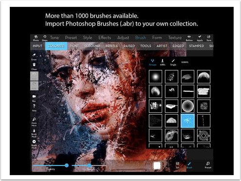
25. Adobe Capture

Adobe Capture is an intriguing bridge between the physical world and the digital studio.
Using the phone’s camera, visual information encountered in everyday life can be transformed into colour themes, patterns, vector shapes, materials and brushes for use elsewhere in the Adobe ecosystem.
For photographers who work across photography, collage, graphic design, books or mixed media, it can be extremely useful.
There is, however, an important caveat for 2026. Adobe currently offers Capture for iOS, but it is no longer available as a new download through Google Play. Existing Android users who already have it installed may continue using it, but Adobe says they cannot reinstall it after removing it. That is precisely why app guides need updating.
An application appearing in a five-year-old “best photography apps” article tells us remarkably little about whether it is useful — or even downloadable — today.
BUILD A TOOLKIT, NOT AN APP COLLECTION
I could continue. There are excellent applications for hiking, air quality, lightning, public transport, translation, note-taking, scanning, cloud storage, remote camera control, light metering and dozens of other peripheral tasks. But downloading 50 applications isn’t the point.
The more useful approach is to build a small collection around the photography you actually make.
If I photographed landscapes regularly
I would start with:
PhotoPills + Met Office + Windy + OS Maps + PeakFinder + a tide app.
That combination gives me light, astronomical planning, weather, terrain, navigation, mountain identification and water conditions.
If I photographed the night sky
I would choose:
PhotoPills + Clear Outside + Stellarium + AuroraWatch UK.
If I photographed wildlife
I would add:
Merlin Bird ID + iNaturalist + OS Maps.
If I photographed cities and travelled frequently
I would want:
Google Maps + Google Earth + PhotoHound + Citymapper + Sun Surveyor.
If I worked commercially with people
I’d add:
Easy Release, together with the planning, navigation and weather tools appropriate to the shoot.
The best photographic toolkit isn’t the one with the most apps.
It is the one that removes uncertainty without removing curiosity.
BUT ARE WE BECOMING TOO GOOD AT PREDICTING THE PHOTOGRAPH?
This is the part that interests me most. Photography has always contained an element of chance.
We arrive somewhere and the light changes. Someone unexpectedly walks into the frame. Fog appears. Rain begins. The Sun disappears. A bird lands somewhere we hadn’t anticipated. Sometimes the photograph we planned fails completely, and another, considerably better photograph appears in its place. Our smartphones increasingly allow us to reduce that uncertainty.
We can predict the Sun and Moon, inspect the location remotely, watch approaching cloud, track the tide, monitor auroral activity, identify the mountain and calculate precisely when to arrive.
Now applications are beginning to go a stage further and tell us when conditions themselves might become photogenic. There is obvious value in this.
If I have to drive three hours and climb a hill before sunrise, I would quite like some indication that there is a possibility of seeing something when I arrive. But photography cannot become merely the execution of a prediction.
If thousands of photographers use the same software to identify the same viewpoint, the same celestial alignment and the same “perfect” conditions, technological precision can paradoxically produce visual conformity.
The app should inform the photographer.
It should never become the photographer.
My Essential Five
If you’re reading this and don’t want another screen full of applications, these are the five I would begin with.
1. PhotoPills — Best overall
The broadest, genuinely photographic planning toolkit, and the one I think most photographers will find something useful in.
2. Met Office — Best UK essential
Not glamorous, but weather affects almost everything we photograph outdoors, and the newly rebuilt 2026 application makes it an obvious starting point for British photographers.
3. Google Earth — Best unexpected photography app
Extraordinary for understanding a location before setting foot there.
4. PeakFinder — Best specialist discovery
A beautifully focused application that helps turn anonymous mountains into identifiable places — and works offline.
5. Merlin Bird ID — Best example of thinking beyond photography apps
It doesn’t improve your camera.
It improves your understanding of what you’re photographing.
And perhaps that is the most important distinction in this entire article.
The Camera Is Only Part of the Photographic Toolkit
The most interesting thing about these applications is not what they tell us about smartphones. It is what they tell us about photography. Making photographs has never begun and ended with pressing a shutter.
Photographers research. We travel. We watch. We wait. We calculate. We return. We learn the rhythms of places and people. We study light. We watch weather. We notice when something changes.
The smartphone has simply condensed an extraordinary number of those supporting activities into a device already sitting in our pockets.
It has become our compass, ephemeris, weather station, tide table, planetarium, field guide, map, notebook, location scout and occasionally our safety net.
Used well, none of these applications makes photography easier in the sense of making the creative decisions for us.
They give us information. What we choose to do with that information remains the photograph. And I think that distinction matters.
Before the photograph comes the prediction.
But after the prediction, the photographer must still come.
Support TheAppWhisperer
If you’ve found this article useful and would like to support independent photography journalism, please consider making a small donation to TheAppWhisperer.
Since 2009, TheAppWhisperer has published thousands of interviews, reviews, opportunities, and essays dedicated to photography and mobile art, remaining free to read for everyone. Every contribution helps support the time, research, and editorial work that goes into producing and preserving this archive.
Your support helps keep thoughtful photography writing alive.

Joanne Carter
Joanne Carter is a British photographer, photography journalist, editor and curator and the founder and editorial director of TheAppWhisperer.com, an independent international photography publication established in 2009.Her journalism, criticism and commentary have appeared in The Times, The Sunday Times, The Guardian, Financial Times, BBC, Vogue Italia, LensCulture, Popular Photography, Android Magazine, NikonPro, DPReview, Which Digital Camera and Which Camera. She has lectured internationally on photography and mobile art, served as a juror for international photography awards, and exhibited her own photographic work across the UK, Europe, South Korea and the United States.Alongside her editorial work, Joanne's photographic and postgraduate research explores death, grief, memory, representation and social inequality through contemporary photography, participatory practice and visual research methods, with the longer-term aim of developing this work through doctoral research.Through TheAppWhisperer, she continues to publish independent photography journalism spanning contemporary photographic practice, mobile imaging, photographic apps, computational photography and emerging imaging technologies.Joanne is available for editorial commissions, photography projects, judging, curatorial work, speaking engagements, consultancy and selected collaborations.